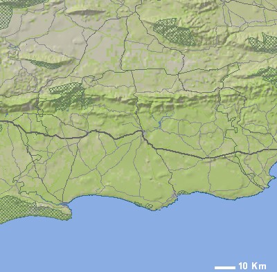
| | | SYMBOLS USED ON THE INTERACTIVE MAP ABOVE |  | Town |  | Wilderness area |  | Town with accommodation |  | National Park / Reserve |  | Adventure |  | Mountain Bike Trail | | Zoom in to detail map |  | 4x4 Trail |  | Route number |  | Hiking |  | Accommodation |  | Wine tasting |  | Attraction |  | Photo (north orientated) |
|
| SELECTED IMAGES | 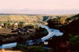 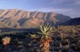 |
| | | MOST POPULAR DESTINATIONS | |
|
| |
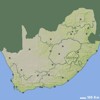
| | SMALLER SCALE MAPS (ZOOM OUT) | 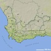 | Western Cape Map
Regions: Greater Beaufort West, Bergrivier, Greater Bitterfontein, Breede River, Breede Valley, Cape Agulhas, Greater Cape Town, Cederberg, De Hoop, Drakenstein, Greater George, Kannaland, Greater Knysna, Greater Laingsburg, Langeberg, Matzikama, Greater Mossel Bay, Greater Murraysburg, Greater Oudtshoorn, Overstrand, Greater Plettenberg Bay, Greater Prince Albert, Greater Saldanha, Greater Stellenbosch, Swartland, Greater Swellendam, Theewaterskloof, Greater Touwsrivier, Greater Uniondale and Witzenberg. |
|
| MORE MAPS RELATED TO LANGEBERG | | Cape Town and Overberg Perspective Map
Size: 940 x 600 mm
Price: |
| Garden Route Map (western direction)
Size: 470 x 734 mm
Price: |
|
| |