Bergville maps
> South Africa > Kwazulu Natal > Uthukela
saexplorer|Information
by  Location
HOME | SERVICES | 
    

  MAPS  

  PLACES  

  ACCOMMODATION  

  DISTANCES  

  CAR RENTAL  

  CLIMATE  

Search: GO! 
 
SYMBOLS USED ON THE INTERACTIVE MAP ABOVE
Location highlighter
Zoom in to detail map
TownWilderness area
Town with accommodationNational Park / Reserve
AdventureMountain bike route
Major route4x4 Trail
Minor routeHiking
AccommodationWine tasting
AttractionPhoto (north orientated)
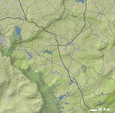
IMAGES IN OR NEAR BERGVILLE
Cathedral Peak
SPONSORS
 
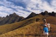
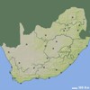
OTHER INTERACTIVE MAPS RELATED TO BERGVILLE
South Africa Map
Places of interest: Cape Town, Knysna, Johannesburg, Durban, Stellenbosch, Hout Bay, Plettenberg Bay, Pretoria, Hermanus and Oudtshoorn.
Eastern Cape Map
Places of interest: Knysna, Durban, Plettenberg Bay, Port Elizabeth, East London, Bloemfontein, Umhlanga, Wilderness, Addo and Jeffreys Bay.
Free State Map
Places of interest: Johannesburg, Bloemfontein, Benoni, Midrand, Kempton Park, Pietermaritzburg, Randburg, Clarens, Howick and Underberg.
Kwa-zulu Natal Map
Places of interest: Durban, Umhlanga, St. Lucia, Hluhluwe, Pietermaritzburg, Amanzimtoti, Clarens, Underberg, Howick and Durban North.
Eastern Free State Map
Places of interest: Clarens, Underberg, Winterton, Bergville, Welkom, Ladybrand, Nottingham Road, Rosetta, Ficksburg and Fouriesburg.
Indlovu Map
Places of interest: Durban, Umhlanga, Amanzimtoti, Pietermaritzburg, Underberg, Howick, Margate, Durban North, Bergville and Salt Rock.
Umzinyathi Map
Places of interest: Bergville, Dundee, Winterton, Rorkes Drift, Ladysmith, Newcastle, Van Reenen, Wakkerstroom, Estcourt and Osizweni.
MORE MAPS RELATED TO BERGVILLE
 
 
2022 © SA Explorer